How to Explore the Montgrí Massif and Its Castle?
Just an hour away from the Cala Llevado campsite, the Montgrí Massif overlooks the Ter Valley. It offers visitors beautiful hiking trails, breathtaking views of the entire region, and a fascinating historical heritage to discover.
The Montgrí Massif
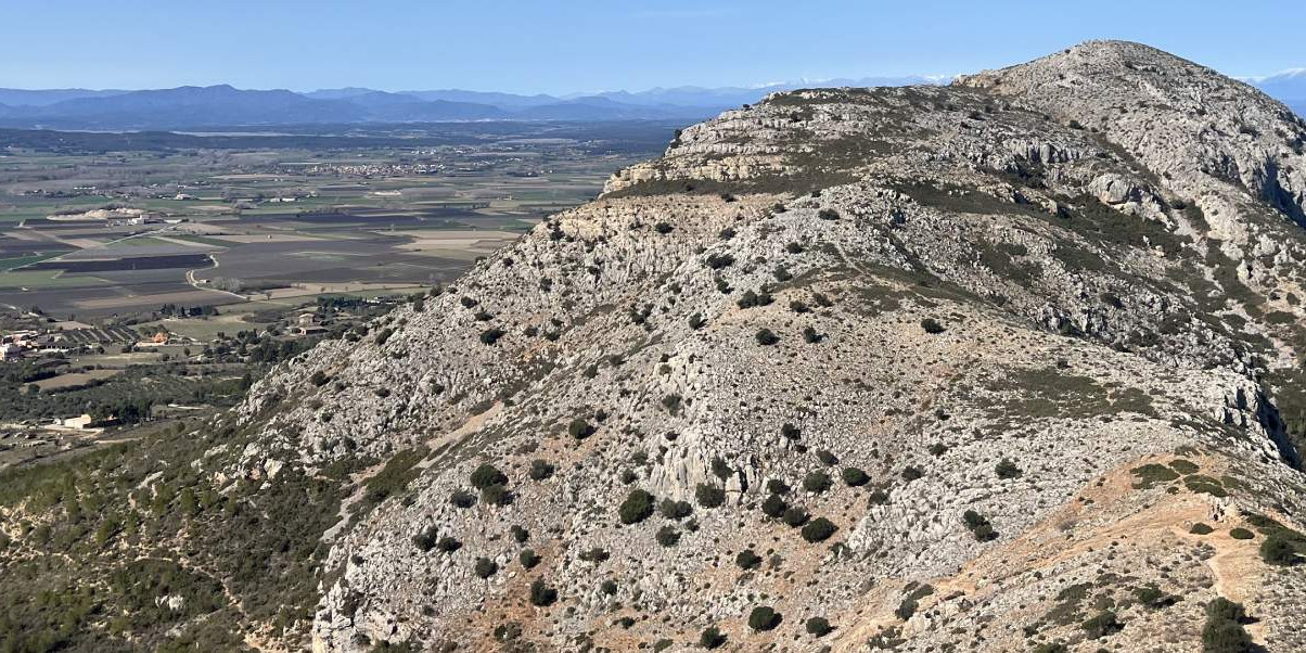
The Montgrí Massif is composed of three limestone hills and is located 6 kilometers from the coast in Catalonia, northeast of Girona. Although its highest point is only 315 meters, it provides a clear 360° view of the Empordà plain, the Ter Valley, Mount Canigó in the Pyrenees, the Bay of Roses, and the Medes Islands. In this rather arid land, home mainly to scrubland, pine trees, and oaks, the Montgrí Castle stands watch over the surroundings. About twenty minutes north, the Santa Caterina hermitage, dating back to the 18th century, is reachable by a path that once served as an important route for religious processions. Today, the Montgrí Massif is part of the Montgrí Natural Park, which also encompasses the Medes Islands off the coast of L'Estartit. While it is not accessible by car, the Montgrí Massif is easy to explore on foot, and the castle is open for visits.
Visiting Montgrí Castle
Built in the late 13th century under King James II of Aragon as a defense against the Count of Empúries, Montgrí Castle is the historical emblem of the massif. Its history, however, was unfortunately short-lived. After the consolidation of the counties of Barcelona and Empúries around 1301, construction ceased, and the castle was eventually abandoned at the end of the 15th century. Its design was inspired by the architecture the Crusaders encountered in the East. Its four cylindrical towers form a cube measuring 31 meters on each side and 13 meters in height. The castle is freely accessible to determined hikers, who can only imagine the challenges of building such a fortress in this elevated location. To reach it, take the Cami dels Tres Pins trail, starting next to the welcome parking lot in Torroella de Montgrí. The ascent takes about 30 minutes, depending on your physical condition. From the top, the view is stunning...
Hiking in the Montgri Massif
If you come to the Montgri Massif, it's to walk! The trails are well-marked and fairly easy, so you don't need to be an experienced hiker to enjoy the scenery. A parking area is located along Ronda Pau Casals Street in Torroella de Montgri. From there, several hiking trails allow you to explore the massif:
The Cami dels Tres Pins leads to the castle, passing through the pass where small stone chapels mark the pilgrimage route to the Santa Caterina hermitage.
The Cami del Xiprer d’En Navarro skirts the massif from the east and then ascends to the castle.
At the far east of Ronda Pau Casals Street, the Cami de Torroella a les Dunes runs along the massif to the Casa de les Dunes. From there, you can climb to the hermitage. An interesting route is to take the Cami dels Tres Pins, pass through the pass and the castle, then continue on the Montpla to head to the hermitage. From there, simply follow the trail back to the pass to return to Torroella de Montgri. On the way down, more athletic hikers can visit the Duc de Torroella cave, used by humans in the Paleolithic era. You can also start with the Cami de Torroella a les Dunes, then go through the hermitage and the castle. Since the massif offers very little shade, try to visit early in the day, especially if you're there during summer vacation. Remember to bring water, a snack, or even a picnic (leave no trace behind).
How to get to the Montgri Massif?
Torroella de Montgri is about an hour and fifteen minutes' drive from the Cala Llevado campsite in Tossa del Mar. To get there, take the GI-681 until the junction with the C-35. Head north via the C-65 and then the C-31 to Torroella de Montgri.
